


Arizona, the Grand Canyon State that has cacti-filled Sonoran Desert landscape offers different trails to the avid hikers. Hiking in the desert has its own beauty as well as dangers lurking in the grooves. The summer is pretty harsh here so the hikers would prefer hiking the upcountry during the hot season. A few precautions taken by the hikers will help them stay safe. Never never under estimate the power of nature! Stay safe while hiking!
HIKING TIPS:
Stay hydrated.
Pack a snack or two.
Carry your first-aid kit.
Inform your family member & share your location.
If possible hike with another person
Stay on the trail.
Yield to the hikers going up.
Pack out what you pack in.
Keep your pet on leash. Not that everyone share your love for pets.
A list of a few Arizona hikes we have done over the past few years is given below and some of them we have hiked many times that we lost count, especially the ones near Scottsdale areas. 😃
Arizona Hiking Trails – Easy
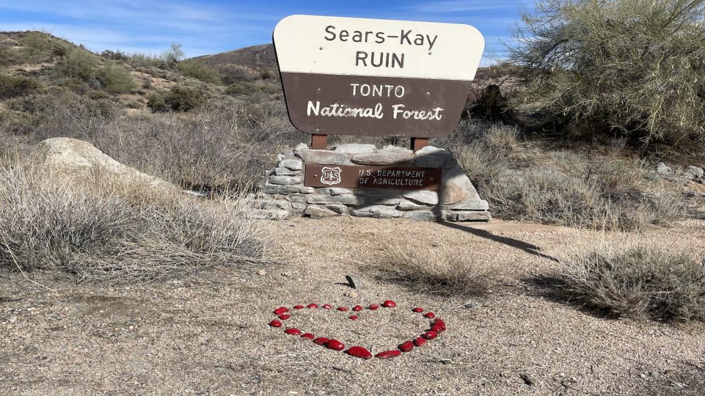
Trail Name: Sears-Kay Ruin
(Tonto National Forest)
Location: Scottsdale
Distance: 1.6 (loop)
Elevation Gain: 364 ft
Point of Interest: Native American Ruins
Rating: Easy
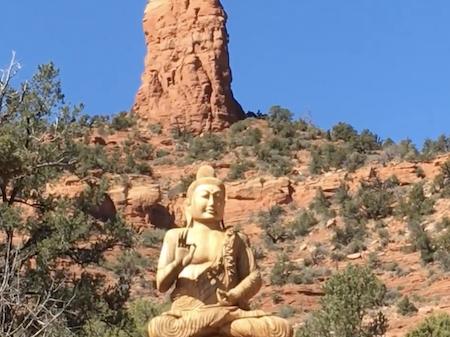
Trail Name: The Amitabha Stupa & Peace Park
Location: Sedona
Distance: 0.5 mile (loop)
Elevation Gain: 50 ft
Point of Interest: A large Buddha Statue and Stupa
Rating: Very Easy
Arizona Hiking Trails – Moderate
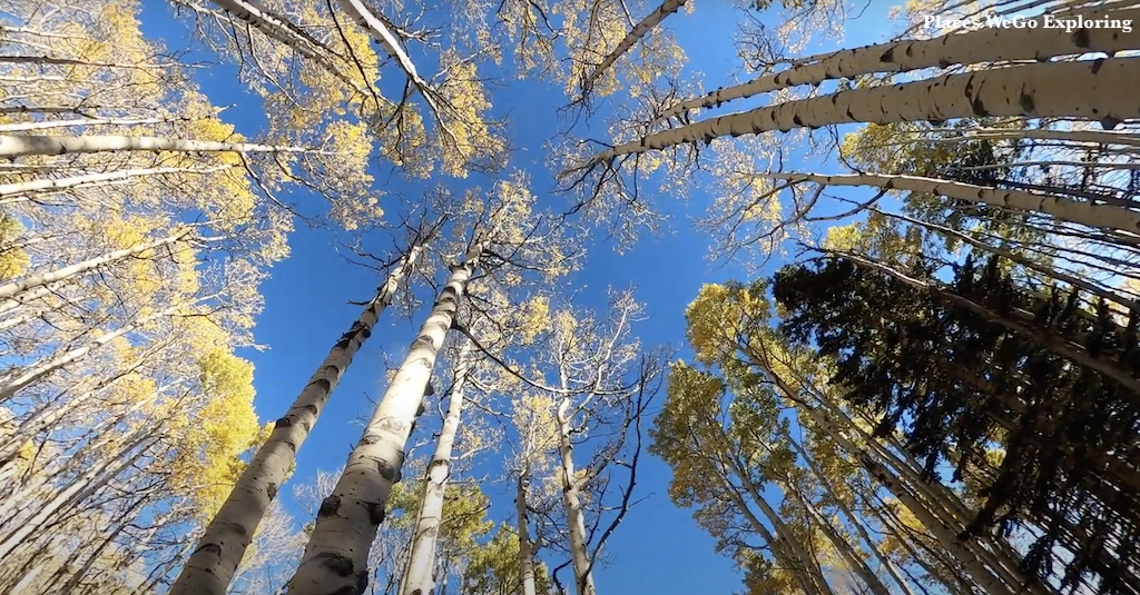
Trail Name: Locket Meadow Inner Basin Loop
Location: Flagstaff, Arizona
Distance Covered: 8 miles (loop)
Elevation Gained: 1000 ft
Interesting Views: Most Popular for fall colors, Aspen Trees
Route Type: Loop
Rating: Moderate
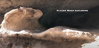
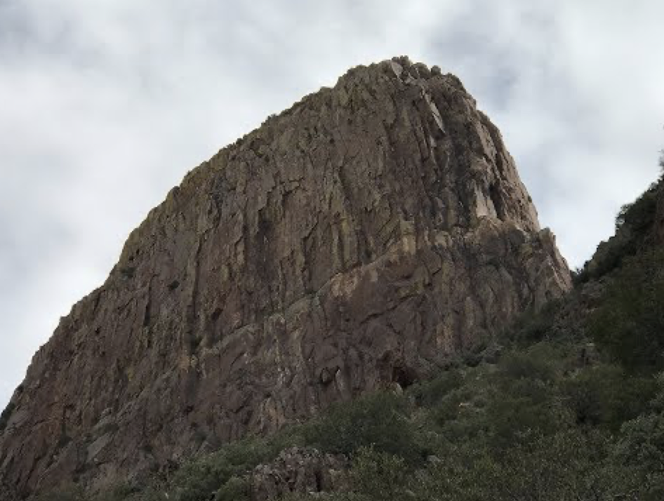
Trail Name: Wave Cave
Location: Gold Canyon
Length: 3 mile
Elevation Gain: 869 ft
Interesting Views: Huge rock formation jutting out like a wave.
Route Type: Out & back
Difficulty: Moderate
Arizona Hiking Trails – Hard
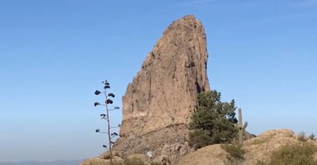
Trail Name: Flatiron via Siphon Draw Trail
Location: Apache Junction
Length: 5.5 miles
Elevation Gain: 2,641 ft
Summit: 5057 feet
Interesting Views: Huge rock formation jutting out like an iron table
Route Type: Out & back
Difficulty: Hard
Trail Name: Weaver’s Needle and Fremont Saddle via Peralta Canyon Trail
Mountain: Superstition Wilderness
Location: Gold Canyon, Arizona
Miles: 7.7 miles (out and back)
Elevation Gain: 2588 feet
Rating: Hard
Arizona Hiking Trails – Easy
- Amitabha Stupa & Peace Park in Sedona
- ‘A’ Mountain on Hayden Butte in Tempe
- Apache Waterfalls Hike in Globe
- Arizona’s Joshua Tree Forest, Meadview
- Lower Salt River Trail in Mesa
- Grand Falls (aka) Chocolate Falls Hike in Flagstaff
- Fountain Lake Overlook Loop Trail in Fountain Hills
- Double Butte Loop Trail in Phoenix
- Horseshoe Bend Overlook Trail in Page
- Antelope Canyon (Upper and Lower) in Page
- Antelope Canyon X in Page
- The New Wave in Page
- Glen Canyon Dam Overlook, Page
- Chimney Rock Hike from Amitabha Stupa & Peace Park in Sedona
- Marcus Landslide Trail in Scottsdale
- Granite Mountain & Balanced Rock in Scottsdale
- Brown’s Ranch Trail in Scottsdale
- Levee Trail Hike, McDowell Mountains in Scottsdale
- McDowell Mountain Ranch Javelina Trail in Scottsdale
- Dixie Mountain Loop (Horned Owl Nest ) in Phoenix
- Hole in the Rock in Phoenix
- Waterfall & Black Rock Loop Trail in Scottsdale
- Dragonfly Trail in Cave Creek
- Chasing The Poppies in Peridot
- Cone Mountain & Brown’s Ranch Mountain in Scottsdale
- Jane Rau Brown’s Canyon Trail in Scottsdale
- Lost Dog Trailhead to Taliesin West in Scottsdale
- Sears-Kay Ruin (Tonto National Forest) in Scottsdale
- Blue Wash Trail to Camp Creek Waterfall in Cave Creek
- Apache Wash Loop & Sidewinder Trail in Phoenix
- Sidewinder & Tower Road Hike in Phoenix
Arizona Hiking Trails – Moderate
- West Fork Trail in Sedona
- Devil’s Bridge in Sedona
- Wind Cave Trail near Mesa
- Shaw Butte North Mountain Hike in Phoenix
- Holbert Trail to Dobbins Lookout at South Mountains in Mesa
- Sunrise Peak via Sunrise Trail in Scottsdale
- Lost Dog Wash Trailhead to Sunrise Peak in Scottsdale
- Bell Pass Trail in Scottsdale
- Riding the Wave in the Arizona Desert in Phoenix
- Bartlett Lake Reservoir Hike in Scootsdale
- Gateway Saddle Loop Trail in Scottsdale
- Pinnacle Peak Trail in Scottsdale
- Deem Hills Ridgeline Hike in Phoenix
- Tonto Natural Bridge Park in Tonto
- Lockett Meadow Inner Basin Trail in Flagstaff
- Broadway Cave in Superstition Wilderness in Phoenix
- Quartz Trail in Paradise Valley – Scottsdale
- Hieroglyphic Trail in Apache Junction
- Rainbow Valley to Toothhaker Trail in Estrella Mountain, Goodyear
Arizona Hiking Trails – Hard
- Humphreys Peak in Flagstaff – the highest natural point in the state
- Agassiz Peak – Arizona’s second highest peak – Chair Lift Ride
- Flatiron Via Siphon Draw Trail, near Phoenix – ^5057 feet
- Thompson Peak Tower Hike in Fountain Hills – ^3,982 feet at the summit
- Weavers Needle, Gold canyon
- Picket Post Trail, Superior, Arizona – ^4378 feet
- Elephant Mountain Trail Hike on Spur Cross Ranch, Cave Creek
- Gateway Long Loop Trail (10.9 miles) Scottsdale
- Bell Rock Hike (Climb), Sedona
- Tom’s Thumb Hike, Scottsdale
- Tom’s Thumb Trail to Lookout Trail, Scottsdale
- Tom’s Thumb Trailhead from Gateway Trailhead, Scottsdale
- Camelback Mountain – Hiking up through Echo Canyon Trail
Part 1 & Part 2 – Hiking Down Cholla Trail, Phoenix - Piestewa Peak – (Sunset Hike), Phoenix
- Dixie Peak / Two Bit Peak – Dixie Mountain Loop, Paradise Valley
- Black Mountain – Cave Creek
- Browns Peak via Brown’s Trail, Four Peaks Wilderness
Happy Hiking & Exploring! 😘