


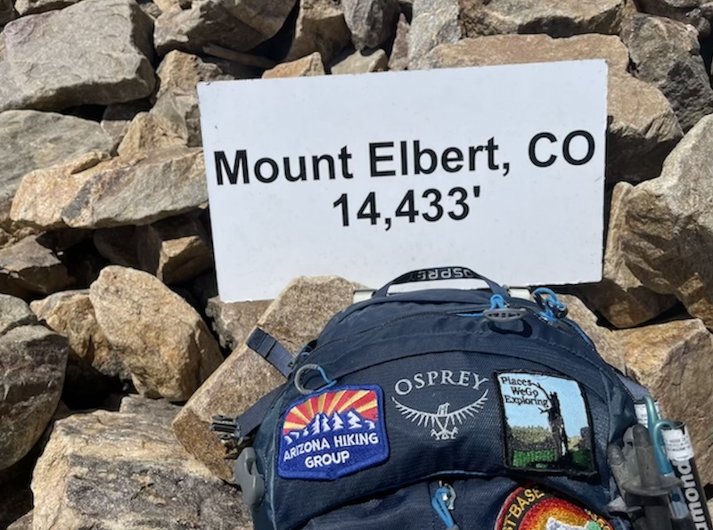
Mount Elbert is Colorado’s highest peak and the second highest peak in the lower 48 states with an elevation of 14,433 feet. There are two main routes to the summit, which are the South Mt. Elbert Trail and the North (Main) Mt. Elbert Trail, both being well trodden class one trails. These relatively easy paths to the summit are busy in the summer, attracting all types of hikers and climbers.
Mount Elbert is the highest summit of the Rocky Mountains, the highest point in the U.S. state of Colorado, and the second-highest summit in the contiguous United States. The ultra-prominent 14,440-14433 ft (4399 m)foot fourteener is the highest peak in the Sawatch Range, as well as the highest point in the entire Mississippi River drainage basin. Mount Elbert is located in San Isabel National Forest, 12.1 miles southwest of the City of Leadville in Lake County, Colorado
Stats:
Trail Name: North Mount Elbert Trail
Trailhead: Mount Elbert Trailhead
Location: San Isabel National Forest, Colorado, USA
Distance: 10.4 miles (16.7 km) + a mile from the parking
Trail Type: Out and Back
Permit: Not required
Trailhead Elevation: 10059 ft (3065 m)
Mount Elbert Elevation: 14433 ft (4399 m)
Gain/Loss: +4468 ft (+1362 m)
Rating: Difficult